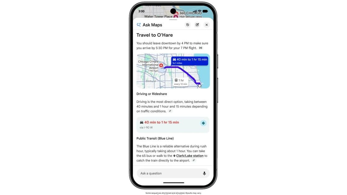
Google Maps users in the Philippines can now type or speak a question like "Are there any closed or flooded roads from Quezon City to BGC?" and get a live answer. Ask Maps, Google's conversational AI feature inside the Maps app, rolled out to Filipino users this week — and Google has described the wider Maps overhaul it belongs to as the biggest transformation of its mapping service in more than a decade.
What Ask Maps can do
Ask Maps adds a button below the search bar in the Google Maps app. Tap it, then type a question or use the microphone to speak one. Instead of returning a list of pins, the feature answers in plain language, drawing on the same live data Maps already collects.
According to local reporting on the rollout, the feature can:
- Report road closures and flooding along a route, such as between Quezon City and BGC
- Give live updates on traffic delays and current road conditions
- Find nearby businesses and say whether they are open right now
- Suggest alternative routes and faster destinations
- Plan an itinerary around your preferences and the weather
Because the feature is conversational, follow-up questions work too — you can refine an answer instead of starting a new search.
Timed for habagat season
The Philippine rollout lands in the middle of the rainy season, when Metro Manila commutes can change by the hour. The examples Google is highlighting locally lean into that: one prompt asks for "the best ramen or noodle soup place in Ortigas that I don't have to walk in the rain for," and the feature can weigh weather conditions when it suggests places and routes.
That makes Ask Maps the second weather-aware Google feature to reach Filipino users this typhoon season, after hourly AI weather forecasts arrived in Search, Gemini, and Maps.
A global feature that took six months to get here
Ask Maps is powered by Google's Gemini AI and first launched in the United States in March 2026. 9to5Google reported in August that the feature then expanded in English to more than 150 countries and territories, including Australia, Brazil, Canada, Indonesia, Japan, and Mexico — the wave the Philippines now joins.
The global version has been gaining abilities as it spreads. In markets where they are enabled, Ask Maps can surface real-time transit departures like a virtual departure board, remember earlier planning conversations when history is turned on, and — in the United States only, for now — complete tasks like ordering food or booking a hotel. Google has not said when those agentic features will reach other countries, including the Philippines.
What it means for Filipino commuters
For the millions of Filipinos who already use Google Maps daily, this is a free addition to an app they have installed — there is no separate download and no subscription. The practical shift is that flood and closure information, which usually spreads through radio reports and social media posts, can now be asked for directly inside the navigation app, in English, at the moment you are deciding whether to leave.
The usual caveat applies: Ask Maps is only as good as the live data behind it, so treat its answers as guidance rather than guarantees, especially during fast-moving weather. But arriving at the height of habagat season, it is a genuinely useful upgrade rather than a novelty — and it changes what a navigation app most Filipinos already carry can actually tell them.