2 min read
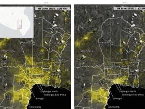
PhilSA Satellite Imagery Pinpoints Power Losses Across Mindanao After Magnitude 7.8 Quake
The Philippine Space Agency used nighttime satellite light data to map power outages and likely evacuations across General Santos City, Sarangani, and South Cotabato from the June 8 magnitude 7.8 offshore Sarangani earthquake.